
6.5 Natural Hazards
Where do natural hazards happen and how do we prepare for them?
Unit Summary
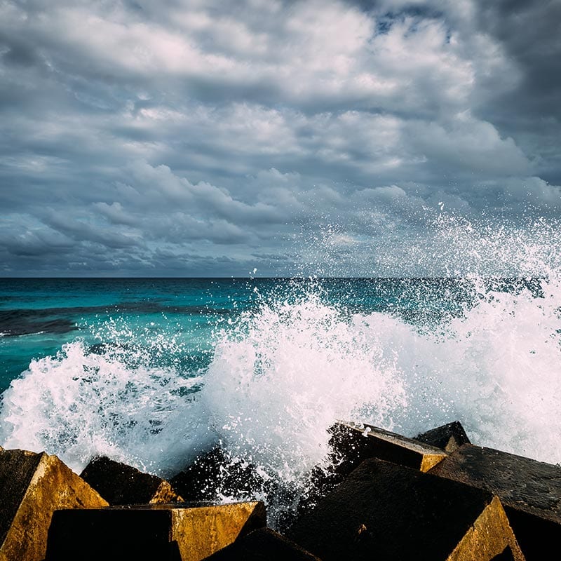
This unit begins with students experiencing, through text and video, a devastating natural event that caused major flooding in coastal towns of Japan. This event was the 2011 Great Sendai or Tōhoku earthquake and subsequent tsunami that caused major loss of life and property in Japan. Through this anchoring phenomenon, students think about ways to detect tsunamis, warn people, and reduce damage from the wave. As students design solutions to solve this problem, they begin to wonder about the natural hazard itself: what causes it, where it happens, and how it causes damage.
The first part of the unit focuses on identifying where tsunamis occur, how they form, how they move across the ocean, and what happens as they approach shore. The second part of the unit transitions students to consider combinations of engineering design solutions and technologies to mitigate the effects of tsunamis. Finally, students apply their understanding to consider how to communicate about another natural hazard to stakeholders in a community.
*Note about recent changes to this unit - In February 2022 the development team adjusted the unit to include a new section building towards MS-PS4-3: Integrate qualitative scientific and technical information to support the claim that digitized signals are a more reliable way to encode and transmit information than analog signals. This updated version integrates a new Lesson 8 into the storyline that focuses on developing PS4-3 through further exploration of hazard communication systems and different signals used to send alerts to communities. Using text, images, and videos, students explore the evolution of emergency communication systems over time. They obtain information about the benefits and challenges of different systems, and in particular, the types of signals used to alert people. Students gather information from the text and multimedia to support the claim that digital signals are more reliable ways to transmit information. The remaining lessons in the unit are unchanged.
Simulations


Unit Examples
Additional Unit Information
Next Generation Science Standards Addressed in this Unit
Performance Expectations
- MS-ESS3-2: Analyze and interpret data on natural hazards to forecast future catastrophic events and inform the development of technologies to mitigate their effects.
- MS-PS4-3: Integrate qualitative scientific and technical information to support the claim that digitized signals are a more reliable way to encode and transmit information than analog signals.
- MS-ETS1-1*: Define the criteria and constraints of a design problem with sufficient precision to ensure a successful solution, taking into account relevant scientific principles and potential impacts on people and the natural environment that may limit possible solutions.
- MS-ETS1-2*: Evaluate competing design solutions using a systematic process to determine how well they meet the criteria and constraints of the problem.
Disciplinary Core Ideas
- ESS3.B: Mapping the history of natural hazards in a region, combined with an understanding of related geologic forces can help forecast the locations and likelihoods of future events. Students use historical tsunami data, videos, simulations, and physical models to investigate where and why tsunamis form, how they move across the ocean, and what happens as the wave approaches shore. They also use historical data for nine other natural hazards to determine general patterns of risk and their own local level of risk for each hazard.
- ETS1.A: The more precisely a design task’s criteria and constraints can be defined, the more likely it is that the designed solution will be successful. Specification of constraints includes consideration of scientific principles and other relevant knowledge that are likely to limit possible solutions. Students use criteria and constraints, based on the science and engineering ideas developed in the unit, to evaluate design solutions and technologies that work together to mitigate the effects of natural hazards.
- ETS1.B: There are systematic processes for evaluating solutions with respect to how well they meet the criteria and constraints of a problem. Students systematically evaluate structure design solutions and technologies to determine how well they meet criteria and constraints for communities and stakeholder groups.
Science and Engineering Practices
- Analyzing and Interpreting Data: Students construct and/or use multiple graphical displays (e.g., maps, scatter plots) of large data sets to identify linear relationship and distinguish between correlation and causation.
- Mathematics and Computation Thinking: This is the first time in 6th grade that students use digital tools to build their own scatter plots with large data sets and look for patterns and trends between multiple variables.
- Constructing Explanations and Designing Solutions: Students construct written explanations during the mid-point (Lesson 4) and summative (Lesson 9) assessments to apply science ideas and evidence to identify areas of risk and why, and to use relationships between variables to support a prediction of risk for tsunami and local natural hazards.
- Engaging in Argument from Evidence: For the first time in 6th grade students are evaluating competing design solutions based on jointly developed and agreed-upon design criteria. Initial students are given some criteria for the tsunami design solutions, but later in the unit, they develop their own jointly agreed-upon criteria for natural hazards communication systems. This scaffolding allows students to practice developing criteria and constraints as a class and then apply them to design solutions.
- Obtaining, Evaluating, and Communicating Information: Throughout the unit students are gathering, reading, synthesizing and evaluating information from multiple sources (e.g., text, data, maps, graphs, images). The scaffolding around this practice lessens so that by the final project in Lesson 9, students are gathering, evaluating, and communicating information independently with a guiding framework for the kinds of information they need, but flexibility to allow
Crosscutting Concepts
- Cause and Effect: Students will build a Tsunami Chain of Event diagram that links together cause-and-effect relationships across science and engineering ideas from the unit. These science and engineering ideas are developed in Lessons 2-7.
- System and System Models: Integrated with the Tsunami Chain of Events is a Hazard System Model that links components of subsystems with those science and engineering ideas about tsunamis. These components and subsystems are developed in Lessons 5-7 and integrated in Lesson 8.
- Stability and Change: Throughout the unit, students often consider the rate of onset of hazards and how quickly a “sudden event” can disrupt the stability of a system. This aspect of the crosscutting concept is used to consider how people will need to respond in such an event.
- The unit also includes opportunities to practice using Patterns; Scale, Proportion, & Quantity; Energy and Matter; and Structure and Function
Connections to the Nature of Science
Which elements of NOS are developed in the unit?
- Science knowledge is based upon logical and conceptual connections between evidence and explanations. (NOS-SEP)
- Science assumes that objects and events in natural systems occur in consistent patterns that are understandable through measurement and observation. (NOS-CCC)
How are they developed?
- Students build a cause-and-effect diagram making logical and conceptual connections between evidence and explanations to refine their predictions of where tsunamis happen and who is most at risk; additionally, they connect engineering designs to different aspects of the causal diagram to add connections for how designs account for evidence and explanations.
- Students learn how analyzing historical data for patterns and trends can help refine predictions for places at risk of hazards. To do this, they study multiple data sets and ways scientists use models and visualizations to track and analyze hazards.
Unit Placement Information
What is the anchoring phenomenon and why was it chosen?
For the anchoring phenomenon, students read text and watch videos of the 2011 Great Sendai or Tōhoku earthquake and tsunami that occurred off the east coast of Japan. This natural hazard caused great devastation to Japan’s coastal communities despite the occurrence of tsunami’s in this area throughout Japan’s history and the engineering preparation that had been done in the area to protect communities. It provides a rich context in which to investigate our abilities to forecast hazards and use engineering design solutions and technologies to mitigate the effects of hazards. Importantly, this phenomenon also highlights the importance of education and communication with people for how to prepare and respond during a natural hazard.
Each OpenSciEd unit’s anchoring phenomenon is chosen from a group of possible phenomena after analyzing student interest survey results and consulting with several external advisory panels. The tsunami hazard for this unit was chosen for three reasons:
- Tsunami hazards build directly upon Disciplinary Core Ideas (DCIs) from 4th grade in which students learned about physical waves. It advances their understanding of mechanical waves by providing a much larger scale phenomenon to investigate.
- Tsunami hazards also directly build upon Disciplinary Core Ideas from grades 6-8 regarding geologic processes and changes in Earth’s surface in OpenSciEd Unit 6.4: What causes Earth’s surface to change? (Everest Unit), which comes just prior to this unit in the OpenSciEd Scope and Sequence. Students leverage their ideas about movement of Earth’s plates to develop a causal mechanism for how tsunamis form.
- Tsunamis have not had a direct impact on US communities in recent years and students in the US have likely not experienced one directly. This is an important consideration in choosing a natural hazard for in depth investigation since a distal hazard is least likely to elicit direct emotional response from students who may have experienced direct devastation from other types of hazards, such as floodings, tornadoes, earthquakes, and/or hurricanes.
How is the unit structured?

The unit is organized into two main lesson sets, each of which help make progress on a sub-question related to the driving question for the entire unit. Lessons 1-4 focus on developing science ideas about tsunamis, and in particular focuses on developing key aspects of science ideas related to where, when, and why tsunamis happen and how they pose risk to certain communities more so than others. Lessons 5-10 transition to focusing on engineering design solutions (structural, technological, and communication & education based systems) to mitigate the effects of tsunamis. Students apply these ideas in a culminating project on another natural hazard event in Lesson 10.
Where does this unit fall within the OpenSciEd Scope and Sequence?
This unit is designed to be taught just after Everest Unit in the OpenSciEd Scope and Sequence. As such, it can leverage ideas about earth system processes that cause motion in Earth’s crust and thus generate the release of energy to form a tsunami wave. The focal DCI for this unit pulls together ideas about where natural hazards are likely to occur based on “related geologic processes,” which is the focus of the Everest Unit.
Additionally, another prior unit, OpenSciEd Unit 6.3: Why does a lot of hail, rain, or snow fall at some times and not others? (Storms Unit), can provide science ideas for students as they investigate other natural hazards in Lesson 10. Many of the hazards that affect US communities are meteorologically-driven hazards, such as hurricanes, flooding, storms, hail, droughts, and tornadoes. Students can bring forward ideas about air temperatures and precipitation patterns from Storms Unit to bolster their final projects for the unit.
Finally, this unit is also designed to be taught after OpenSciEd Unit 6.2: How can containers keep stuff from warming up or cooling down? (Cup Design Unit), which means ideas about energy and energy transfer developed in that unit can be leveraged in Lessons 3 and 5 of this unit. Lesson 2 of this unit also leverages prior ideas about causation and correlation that are developed in the Everest Unit.
What modifications will I need to make if this unit is taught out of sequence?
This is the fifth unit in 6th grade in the OpenSciEd Scope and Sequence, and it is intentionally planned to come just after the 6.4 Plate Tectonics. Given this placement, several modifications would need to be made if teaching this unit earlier or later in the middle school curriculum. These include:
- If this unit is not taught after 6.4 Plate Tectonic, then students will need to develop some ideas around geologic processes related to plate movements and the release of energy that we feel as earthquakes. This is the main causal mechanism for tsunami formation and are prerequisite ideas for Lessons 2 and 3 in this unit, and also an important idea if students investigate earthquakes as a hazard in Lesson 9.
- Additionally, if this unit is taught before 6.2 Thermal Energy, more support will need to be included for helping students identify a design problem and defining criteria and constraints. The current unit assumes students have already done some initial work in this area during the Thermal Energy unit.
What are prerequisite math concepts necessary for the unit?
This unit requires students to triangulate data across different units of measurement and symbology as they work with a series of maps in Lesson 2. It also references units of measurement throughout the unit, such as magnitude or wave height. There are no required math concepts for this unit. However, prerequisite math concepts that may be helpful include:
- CCSS.Math.Content.4.MD.A.1 Know relative sizes of measurement units within one system of units including km, m, cm; kg, g; lb, oz.; l, ml; hr, min, sec. Within a single system of measurement, express measurements in a larger unit in terms of a smaller unit. Record measurement equivalents in a two-column table.
- CCSS.Math.Content.5.NBT.A.3 Read, write, and compare decimals to thousandths.
- CCSS.Math.Content.5.NBT.A.4 Use place value understanding to round decimals to any place.
It is important to note that this unit is reinforcing some elementary mathematics standards in a new context and using scales at which students may have not considered before; thus, we anticipate that while some of the mathematics in this unit is aligned to upper elementary math development, it may be a new challenging context for students to apply the mathematics ideas.
How do I shorten or condense the unit if needed? How can I extend the unit if needed?
The following are example options to shorten or condense parts of the unit without eliminating important sensemaking for students:
- Lesson 2: Conduct mapping and graphing exercises as a whole class. Project maps and graphs onto a whiteboard and ask students to volunteer to annotate a shared class map or graph using a dry erase marker.
- Lesson 2 & 3: Wait to build Tsunami Chain of Events in one pass at the end of Lesson 3 or beginning of Lesson 4.
- Lesson 5: Use the prefilled design matrix with the rankings already provided instead of having students make one from scratch.
- Lesson 10: Exchange communication project to a individual written explanation that includes information about the hazard (what it is, where it happens, what time of year does it happen, why it happens), information about the community and stakeholders at risk, and at least three design solutions or technologies that can be used to help protect and prepare communities.
To extend or enhance the unit, consider the following:
- Lesson 3: If the unit is taught after Sound Unit, consider bringing in middle school level DCIs on waves (MS-PS4.A) and model the wavelength, amplitude, and frequency of tsunamis based on stronger or weaker precipitating events (e.g., earthquakes).
- Lesson 5: Have students jigsaw the different design solutions and research more about them and how they are used in Japan.
- Lesson 8: If students have done substantial work with middle school wave properties (PS4.A), then this lesson is an opportunity to apply more sophisticated ideas about waves to better understand ‘wave pulses’ in PS4.C.
- Lesson 10: Have students present their projects to community members for feedback and revision prior to releasing the final product to the community.
- All lessons: Remove scaffolds provided with Science and Engineering Practices as a way to give students more independent work with the elements of these practices.
Unit Acknowledgements
Unit Development Team
- Audrey Mohan, Unit Lead, BSCS Science Learning
- Whitney Smith, Unit Lead, BSCS Science Learning
- Ari Jamshidi, Writer, University of California, Berkeley
- Natalie Keigher, Writer, Lisle Junior High School
- Dawn Novak, Writer, BSCS Science Learning
- Tracey Ramirez, Writer, The Charles A. Dana Center, The University of Texas at Austin
- Abe Lo, Reviewer, PD design, BSCS Science Learning
- Mikala Popovec, Pilot teacher, Chicago Public Schools
- Ty Scaletta, Pilot teacher, Chicago Public Schools
- Katie Van Horne, Assessment Specialist, Concolor Research
- Jerry Mitchell, Unit Advisory Chair, University of South Carolina
- Brittany Bird, Advisory Team, Hermosa Middle School
- Cindy Colomb, Advisory Team, Hermosa Middle School
- Michael Novak, Advisory Team, Northwestern University
- Karla White, Advisory Team, Bethany Public Schools
Production Team
BSCS Science Learning
- Kate Herman, Copyeditor, Independent Contractor
- Rosemi Mederos, Copyeditor, Independent Contractor
- Renee DeVaul, Project Coordinator
- Valerie Maltese, Marketing Specialist & Project Coordinator
- Chris Moraine, Multimedia Graphic Designer
- Kate Chambers, Multimedia Graphic Designer
Unit External Evaluation
EdReports
EdReports awarded OpenSciEd an all-green rating for our Middle School Science Curriculum in February 2023. The materials received a green rating on all three qualifying gateways: Designed for the Next Generation Science Standards (NGSS), Coherence and Scope, and Usability. To learn more and read the report, visit the EdReports site.
NextGenScience’s Science Peer Review Panel
An integral component of OpenSciEd’s development process is external validation of alignment to the Next Generation Science Standards by NextGenScience’s Science Peer Review Panel using the EQuIP Rubric for Science. We are proud that this unit has earned the highest score available and has been awarded the NGSS Design Badge. You can find additional information about the EQuIP rubric and the peer review process at the nextgenscience.org website.

Unit standards
This unit builds toward the following NGSS Performance Expectations (PEs) as described in the OpenSciEd Scope & Sequence:
- ESS3-2
- PS4-3
- ETS1-1*
- ETS1-2*
Reference to kit materials
The OpenSciEd units are designed for hands-on learning and therefore materials are necessary to teach the unit. These materials can be purchased as science kits or assembled using the kit material list.
