
6.4 Plate Tectonics & Rock Cycling
What causes Earth's surface to change?
Unit Summary
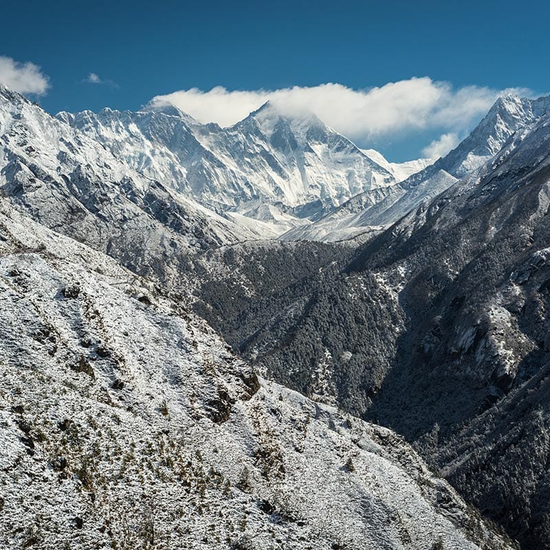
Mountains move! And there are ocean fossils on top of Mt. Everest! In this plate tectonics and rock cycling unit, students come to see that the Earth is much more active and alive than they have thought before. The unit launches with documentation of a 2015 Himalayan earthquake that shifted Mt. Everest suddenly to the southwest direction. Students also discover that Mt. Everest is steadily moving to the northeast every year and getting taller as well. Students wonder what could cause an entire mountain to move during an earthquake.
Students investigate other locations that are known to have earthquakes and they notice landforms, such as mountains and ridges that correspond to earthquake patterns. They read texts, explore earthquake and landform patterns using a data visualization tool, and study GPS data at these locations. Students develop an Earth model and study mantle convection motion to explain how Earth’s surface could move from processes below the surface. From this, students develop models to explain different ways plates collide and spread apart, ultimately explaining how Mt. Everest could move all the time in one direction, and also suddenly, in a backward motion, during an earthquake. The unit ends with students using what they have figured out about uplift and erosion to explain how a fossil was found at Mt. Everest without having to dig for it.

Simulations


Unit Examples
Additional Unit Information
Next Generation Science Standards Addressed in this Unit
Performance Expectations
This unit builds towards the following NGSS Performance Expectations (PEs):
- MS-ESS1-4: Construct a scientific explanation based on evidence from rock strata for how the geologic time scale is used to organize Earth’s 4.6-billion-year-old history.
- MS-ESS2-1: Develop a model to describe the cycling of Earth’s materials and the flow of energy that drives this process.
- MS-ESS2-2: Construct an explanation based on evidence for how geoscience processes have changed Earth’s surface at varying time and spatial scales.
- MS-ESS2-3: Analyze and interpret data on the distribution of fossils and rocks, continental shapes, and seafloor structures to provide evidence of the past plate motions.
Disciplinary Core Ideas
ESS1.C: The History of Planet Earth
- The geologic time scale interpreted from rock strata provides a way to organize Earth’s history. Analyses of rock strata and the fossil record provide only relative dates, not an absolute scale. (MS‑ESS1‑4)
- Tectonic processes continually generate new ocean seafloor at ridges and destroy old seafloor at trenches. (HS.ESS1.C GBE) (secondary to MS‑ESS2‑3)
ESS2.A: Earth’s Materials and Systems
- All Earth processes are the result of energy flowing and matter cycling within and among the planet’s systems. This energy is derived from the sun and Earth’s hot interior. The energy that flows and the matter that cycles
producechemical and physical changes in Earth’s materials and living organisms. (MS‑ESS2‑1) - The planet’s systems interact over scales that range from microscopic to global in size, and they operate over fractions of a second to billions of years. These interactions have shaped Earth’s history and will determine its future. (MS‑ESS2‑2)
ESS2.B: Plate Tectonics and Large-Scale System Interactions
- Maps of ancient land and water patterns, based on investigations of rocks and fossils, make clear how Earth’s plates have moved great distances, collided, and spread apart. (MS‑ESS2‑3)
ESS2.C: The Roles of Water in Earth’s Surface Processes
- Water’s movements—both on land
and underground—cause weathering and erosion, which change the land’s surface featuresand create underground formations. (MS‑ESS2‑2)
Science & Engineering Practices
While this unit engages students in multiple SEPs across the lesson level performance expectations for all the lessons in the unit, there are four focal practices that this unit targets to support students’ development:
- Developing & Using Models
- Using Mathematics & Computational Thinking
- Constructing Explanations and Designing Solutions
- Engaging in Argument from Evidence
Crosscutting Concepts
- Cause and Effect
- Scale, Proportion, and Quantity
- Stability and Change
Connections to the Nature of Science
Which elements of NOS are developed in the unit?
- Science knowledge is based upon logical and conceptual connections between evidence and explanations. (NOS-SEP)
- Scientific explanations are subject to revision and improvement in light of new evidence. (NOS-SEP)
- Science theories are based on a body of evidence developed over time. (NOS-SEP)
- Science assumes that objects and events in natural systems occur in consistent patterns that are understandable through measurement and observation. (NOS-CCC)
- Science limits its explanations to systems that lend themselves to observation and empirical evidence. (NOS-CCC)
How are they developed?
- Students develop a chart listing potential causes of a mountain moving. Using evidence from investigations, they make logical and conceptual connections about potential causes of mountains moving and events that are correlated with mountain movement.
- Students develop an explanation for what causes a mountain to move in Lesson 1 and refine this over the course of the unit as they collect evidence through investigations.
- Across the unit, data to support the movement of plates is pieced together. The data does not work stand-alone, but as a body of evidence.
- The movement of plates is measured and that movement can allow us to determine the past location of continents.
- Students analyze data regarding the composition of the earth to the extent that we can observe it, and draw conclusions about the interior and its associated processes.
Unit Placement Information
What is the anchoring phenomenon and why was it chosen?
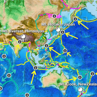
For the anchoring phenomenon, students read text about how Mt. Everest has increased in elevation over time and analyze data cards about 5 other mountains around the world looking for evidence of other mountains changing as well. This phenomenon around the tallest mountain changing in height is confounding and supports students in beginning to think about how other places on Earth’s surface might be changing as well.
Each OpenScied unit’s anchoring phenomenon is chosen from a group of possible phenomena after analyzing student interest survey results and consulting with several external advisory panels. The Mt. Everest, and other mountain cases analyzed in this unit were chosen for the following reasons:
- Mt. Everest, as the tallest mountain above sea level, is familiar to students and surprising to read that a mountain can change in height. In addition, the most recent height was determined when scientists from Nepal and China agreed to share data for more accuracy. This was added to the initial article students read to support the Nature of Science ideas that more data leads to more accuracy.
- Students’ experience with mountains changing over time is mostly limited so a set of 5 other mountain cases are also part of the anchoring lesson to provide students with additional information about whether mountains change. The addition of these data cards helps students begin making connections to changes in the land around the places they live and visit.
How is the unit structured?
The unit is organized into two main lesson sets, each of which help make progress on a sub-question related to the driving question for the entire unit. Lessons 1-9 focus on developing science ideas behind what causes a mountain to grow and/or move. Lessons 10-13 transition to focusing on what can cause other mountains to change elevation and location. In Lesson 14, students apply what they have figured out about how Earth’s surface changes to explain how a fossil can be found on a mountain top.

Where does this unit fall within the OpenSciEd Scope and Sequence?
This unit is designed to be taught just after Storms Unit in the OpenSciEd Scope and Sequence. As such, it can leverage ideas about earth system processes that cause motion above Earth’s surface. Students can bring forward ideas about air temperatures and precipitation patterns from Storms Unit to bolster their final projects for the unit. The focal DCIs center over changes across large spatial and temporal scales and focus on changes that are seemingly small but add up over geologic time, such as the movement of plates over millions of years and erosion and uplift rates creating the increases and decreases to mountain elevation that can only be seen from a distance over large timescales.
Additionally, another prior unit, OpenSciEd Unit 6.2: How can containers keep stuff from warming up or cooling down? (Cup Design Unit), can provide science ideas for students as they investigate how energy transfers between materials and how this transfer of energy results in movement. This means ideas about energy and energy transfer developed in that unit can be leveraged in Lessons 8 and 13 of this unit. The unit also develops or expands students’ understanding of energy flows and matter cycling within Earth’s systems with an emphasis on time and spatial scales.
What modifications will I need to make if this unit is taught out of sequence?
This is the fourth unit in 6th grade in the OpenSciEd Scope and Sequence. Given this placement, several modifications would need to be made if teaching this unit earlier or later in the middle school curriculum. These include:
- If taught before Unit 6.2 Thermal Energy, students will not have developed ideas about thermal energy being transferred between particles and that particles of a material at a higher temperature transfer energy faster than particles of a material at a lower temperature. This idea is built on in the next unit, Unit 6.3 Weather, Climate & Water Cycling. Prior to lesson 8, students will need support in visualizing what is occurring to particles as temperature changes so they can figure out what happens to solid rock that gets heated to very high temperatures under the surface of Earth.
- If taught before Unit 6.3 Weather, Climate & Water Cycling, students will not have developed ideas about density in relation to energy being absorbed by particles and then being transferred between particles. Again prior to lesson 8, students will need some experience with what it means at a particle level when one section of material is denser or less dense than another section of material.
What mathematics is required to fully access the unit’s learning experiences?
This unit exposes students to movement data using different measurements and time scales, and, importantly, the movement of two objects in relationship to one another. Students wrestle with GPS movement data in different directions and also visualizing the depth and breadth of earthquake patterns using a visualization tool. Prerequisite math concepts that may be helpful include:
- CCSS.Math.Content.4.MD.A.1 Know relative sizes of measurement units within one system of units including km, m, cm; kg, g; lb, oz.; l, ml; hr, min, sec. Within a single system of measurement, express measurements in a larger unit in terms of a smaller unit. Record measurement equivalents in a two-column table.
- CCSS.MATH.CONTENT.5.MD.A.1 Convert among different-sized standard measurement units within a given measurement system (e.g., convert 5 cm to 0.05 m), and use these conversions in solving multi-step, real world problems.
- CCSS.Math.Content.5.NBT.A.3 Read, write, and compare decimals to thousandths.
- CCSS.Math.Content.5.NBT.A.4 Use place value understanding to round decimals to any place.
- CCSS.Math.Content.6.RP.A.2 Understand the concept of a unit rate a/b associated with a ratio a:b with b ≠ 0, and use rate language in the context of a ratio relationship.
It is important to note that this unit is reinforcing some elementary mathematics standards in a new context and using scales at which students may have not considered before; thus, we anticipate that while some of the mathematics in this unit is aligned to upper elementary math development, it may be a new challenging context for students to apply the mathematics ideas.
How do I shorten or condense the unit if needed? How can I extend the unit if needed?
The following are example options to shorten or condense parts of the unit without completely eliminating the important sensemaking for students.
- Lesson 1: In this lesson students find that Mt. Everest is growing in height and moving to the northeast. Then, they develop an initial model to capture causes for this to be happening. Next the class develops a consensus model of Everest (mountains growing in height). Next students analyze mountain cards to see if other mountains are behaving the same way as Everest and find some mountains are shrinking in height. Students develop an initial model for what could cause this and the class adds to the consensus model. Instead of having two different Scientist Circle sessions developing two initial consensus models, the students could still develop their initial model at the same points in the lesson, but the class could wait to come together to develop the class model until students have analyzed all mountain cases.
- Lesson 6: This lesson has multiple investigations students are carrying out and is written to take three days. If time is limited, these could be done as demo investigations as a whole class with the students suggesting different ways to move the foam pieces representing the plates. The diagrammatic models that are developed in small groups and gallery walked before consolidating as a whole class could be streamlined so that the models are being developed while this investigation is being demonstrated. This condensation of the lesson could reduce the lesson from three to two days and won’t break any coherence, but it will reduce the individual sense making students do around how plates move and how this movement is related to what we see at the surface.
To extend or enhance the unit, consider the following:
- Lesson 1: Swap out one of the mountain cards and create one for your local location if there are mountains or interesting landforms that students could analyze to help figure out how Earth’s surface changes. Instead of swapping out a mountain card, an extra could also be added for this purpose.
- Lesson 1: Each of the mountains on the mountain cards come from different parts of the world and have numerous names dependent on the cultures that live in the area. For students who are interested, they could research more about the history of the different names of the mountains and the people who live there. Usually these names identify what the people have experienced from living near a mountain – such as the movement of the mountain, or shaking from earthquakes, etc.
- Lesson 13: Data about erosion rates for your local area could be added to this lesson along with plate movement if the landforms in your area lend themselves to this analysis.
Unit Acknowledgements
Unit Development Team
- Dawn Novak, Unit Lead, BSCS Science Learning
- Whitney Smith, Unit Lead, BSCS Science Learning
- Audrey Mohan, Field Test Unit Lead, BSCS Science Learning
- Lindsey Mohan, Writer, BSCS Science Learning
- Ari Jamshidi, Writer, Berkeley
- Karin Klein, Writer, Independent Contractor, BSCS Science Learning
- Tracey Ramirez, Writer, The Charles A. Dana Center, The University of Texas at Austin
- Kirsten Smith, Writer and Pilot Teacher, Pound Middle School, NE
- Abe Lo, Reviewer & PD design, BSCS Science Learning
- Michael Novak, Writer, Reviewer, & Conceptual design, Northwestern University
- Gretchen Brinza, Pilot Teacher, Boulder Valley School District, CO
- Katie Van Horne, Assessment Specialist, Concolor Research
- Matthew Rossi, Unit Advisory Chair, University of Colorado-Boulder
- Paige Kelpine, Advisory Team & Pilot Teacher
- Rachel Poland, Advisory Team, Innovation Middle School, CA
Production Team
BSCS Science Learning
- Maria Gonzales, Copyeditor, Independent Contractor
- Renee DeVaul, Project Coordinator
- Valerie Maltese, Marketing Specialist & Project Coordinator
- Chris Moraine, Multimedia Graphic Designer
- Kate Chambers, Multimedia Graphic Designer
Unit External Evaluation
EdReports
EdReports awarded OpenSciEd an all-green rating for our Middle School Science Curriculum in February 2023. The materials received a green rating on all three qualifying gateways: Designed for the Next Generation Science Standards (NGSS), Coherence and Scope, and Usability. To learn more and read the report, visit the EdReports site.
NextGenScience’s Science Peer Review Panel
An integral component of OpenSciEd’s development process is external validation of alignment to the Next Generation Science Standards by NextGenScience’s Science Peer Review Panel using the EQuIP Rubric for Science. We are proud that this unit has earned the highest score available and has been awarded the NGSS Design Badge. Read the review for this and all of our other units at nextgenscience.org.

Unit standards
This unit builds toward the following NGSS Performance Expectations (PEs) as described in the OpenSciEd Scope & Sequence:
- MS-ESS1-4
- MS-ESS2-1
- MS-ESS2-2
- MS-ESS2-3
Reference to kit materials
The OpenSciEd units are designed for hands-on learning and therefore materials are necessary to teach the unit. These materials can be purchased as science kits or assembled using the kit material list.
NGSS Design Badge
Awarded:Oct 13, 2021
Awarded To: OpenSciEd Unit 6.4: How and Why Does Earth’s Surface Change?
